
 English
 norsk
norskInstitutt for geovitenskap: Recent submissions
Now showing items 201-220 of 1121
-
Evidence of hyperpycnally fed turbidites in a basin floor setting, Eocene of Spitsbergen, Arctic Norway
(Conference object; Konferansebidrag, 2018)The Eocene of Spitsbergen, Svalbard, has received considerable attention in the literature because of its spectacular seismic-scale clinoforms exposed along many fiords and valleys. Previous investigations particularly focused on the slope segment of the clinoforms and demonstrated how sustained-type, hyperpycnal flows deriving from shelf-edge deltas played a major role in bringing sand onto the ... -
Fossil organic carbon utilization in marine Arctic fjord sediments by subsurface micro-organisms
(Journal article; Tidsskriftartikkel, 2023)Rock-derived or petrogenic organic carbon has traditionally been regarded as being non-bioavailable and bypassing the active carbon cycle when eroded. However, it has become apparent that this organic carbon might not be so inert, especially in fjord systems where petrogenic organic carbon influxes can be high, making its degradation another potential source of greenhouse gas emissions. The extent ... -
Petrogenesis and Geodynamic Significance of Xenolithic Eclogites
(Journal article; Tidsskriftartikkel; Peer reviewed, 2023-02-15)Kimberlite-borne xenolithic eclogites, typically occurring in or near cratons, have long been recognized as remnants of Precambrian subducted oceanic crust that have undergone partial melting to yield granitoids similar to the Archaean continental crust. While some eclogitized oceanic crust was emplaced into cratonic lithospheres, the majority was deeply subducted to form lithologic and geochemical ... -
Absence of photophysiological response to iron addition in autumn phytoplankton in the Antarctic sea-ice zone
(Journal article; Tidsskriftartikkel; Peer reviewed, 2023-07-31)he high nutrient–low chlorophyll condition of the Southern Ocean is generally thought to be caused by the low bioavailability of micronutrients, particularly iron, which plays an integral role in phytoplankton photosynthesis. Nevertheless, the Southern Ocean experiences seasonal blooms that generally initiate in austral spring, peak in summer, and extend into autumn. This seasonal increase in primary ... -
Large-scale culturing of Neogloboquadrina pachyderma, its growth in, and tolerance of, variable environmental conditions
(Journal article; Tidsskriftartikkel; Peer reviewed, 2023-08-09)The planktic foraminifera Neogloboquadrina pachyderma is a calcifying marine protist and the dominant planktic foraminifera species in the polar oceans, making it a key species in marine polar ecosystems. The calcium carbonate shells of foraminifera are widely used in palaeoclimate studies because their chemical composition reflects the seawater conditions in which they grow. This species provides ... -
Paleobathymetric reconstructions of the SW Barents Seaway and their implications for Atlantic–Arctic ocean circulation
(Journal article; Tidsskriftartikkel; Peer reviewed, 2023-06-29)Unravelling past, large-scale ocean circulation patterns is crucial for deciphering the longterm global paleoclimate. Here we apply numerical modelling to reconstruct the detailed paleobathymetry-topography of the southwestern inlet of the Barents Seaway that presently connects the Atlantic and Arctic oceans. Subaerial topography was likely enough to block Atlantic Water from entering the Barents ... -
A steady-state model reconstruction of the patagonian ice sheet during the last glacial maximum
(Journal article; Tidsskriftartikkel; Peer reviewed, 2023-07-17)During the Last Glacial Maximum (LGM), the Patagonian Ice Sheet (PIS) was the largest Quaternary ice mass in the Southern Hemisphere outside of Antarctica. Although the margins of the LGM ice sheet are now well established through end-moraine mapping and dating, apart from a few modelling and empirical studies, there remains a lack of constraint on its thickness and three-dimensional configuration. ... -
Svalbard Composite Tectono-Sedimentary Element, Barents Sea
(Journal article; Tidsskriftartikkel; Peer reviewed, 2023-03-06)The Svalbard Composite Tectono-Sedimentary Element (SCTSE) is located on the northwestern corner of the Barents Shelf and comprises a Carboniferous–Pleistocene sedimentary succession. Due to Cenozoic uplift, the succession is subaerially exposed in the Svalbard archipelago. The oldest parts of the succession consist of Carboniferous–Permian mixed siliciclastic, carbonate and evaporite, and spiculitic ... -
Nitrogen uptake by methanotrophic consortia in deep-water gas hydrate-bearing sediments
(Journal article; Tidsskriftartikkel; Peer reviewed, 2023-07-19)Methane-consuming microbes inhabiting marine methane seeps have recently been found to have the capacity to assimilate inorganic nitrogen, suggesting a previously unaccounted role in the global nitrogen cycle. Despite ex-situ experimental observations, definitive evidence of this process under in-situ conditions remains elusive, hindering the complete understanding of the controlling factors and ... -
Event recognition in marine seismological data using Random Forest machine learning classifier
(Journal article; Tidsskriftartikkel; Peer reviewed, 2023-06-16)Automatic detection of seismic events in ocean bottom seismometer (OBS) data is difficult due to elevated levels of noise compared to the recordings from land. Popular deep-learning approaches that work well with earthquakes recorded on land perform poorly in a marine setting. Their adaptation to OBS data requires catalogues containing hundreds of thousands of labelled event examples that currently ... -
A High Arctic inner shelf–fjord system from the Last Glacial Maximum to the present: Bessel Fjord and southwest Dove Bugt, northeastern Greenland
(Journal article; Tidsskriftartikkel; Peer reviewed, 2023-07-10)The Greenland Ice Sheet (GrIS) responds rapidly to the present climate; therefore, its response to the predicted future warming is of concern. To learn more about the impact of future climatic warming on the ice sheet, decoding its behavior during past periods of warmer than present climate is important. However, due to the scarcity of marine studies reconstructing ice sheet conditions on the Northeast ... -
Uncovering hidden structures: previously undescribed pseudopodia and ectoplasmic structures in planktonic foraminifera
(Journal article; Tidsskriftartikkel; Peer reviewed, 2023-07-05)The trophic strategies of cold-water planktonic foraminifera are not well understood due to the challenge of culturing them in polar conditions. Here, we identify previously unknown ectoplasmic and cytoplasmic projections in three species of planktonic foraminifera thriving in polar and subpolar marine environments: Globigerina bulloides, Neogloboquadrina incompta and Neogloboquadrina pachyderma. ... -
Groundwater springs formed during glacial retreat are a large source of methane in the high Arctic
(Journal article; Tidsskriftartikkel; Peer reviewed, 2023-07-06)Permafrost and glaciers in the high Arctic form an impermeable ‘cryospheric cap’ that traps a large reservoir of subsurface methane, preventing it from reaching the atmosphere. Cryospheric vulnerability to climate warming is making releases of this methane possible. On Svalbard, where air temperatures are rising more than two times faster than the average for the Arctic, glaciers are retreating and ... -
The Response of Tidewater Glacier Termini Positions in Hornsund (Svalbard) to Climate Forcing, 1992–2020
(Journal article; Tidsskriftartikkel, 2023-05-19)Many Arctic marine-terminating glaciers have undergone rapid retreats in recent decades. Seasonal and year-to-year variations in terminus position act on all tidewater glaciers, but the key controls on those changes vary from region to region. Here, we examined seasonal and decadal changes in termini positions of seven tidewater glaciers in the inner part of Hornsund, the southernmost fjord of ... -
Shallow-water hydrothermal venting linked to the Palaeocene–Eocene Thermal Maximum
(Journal article; Tidsskriftartikkel, 2023-08-03)The Palaeocene–Eocene Thermal Maximum (PETM) was a global warming event of 5–6 °C around 56 million years ago caused by input of carbon into the ocean and atmosphere. Hydrothermal venting of greenhouse gases produced in contact aureoles surrounding magmatic intrusions in the North Atlantic Igneous Province have been proposed to play a key role in the PETM carbon-cycle perturbation, but the precise ... -
Widespread partial-depth hydrofractures in ice sheets driven by supraglacial streams
(Journal article; Tidsskriftartikkel; Peer reviewed, 2023-06-19)Dramatic supraglacial lake drainage events in Greenland and Antarctica are enabled by rapid hydrofracture propagation through ice over 1 km thick. Here we present a slower mode of hydrofracture, where hairline surface fractures intersect supraglacial streams, and hypothesize that penetration depth is critically limited by water supply and englacial refreezing. We develop a model of stream-fed ... -
The Paleoarchean Buffalo River komatiites: Progressive melting of a single large mantle plume beneath the growing Kaapvaal craton
(Journal article; Tidsskriftartikkel; Peer reviewed, 2023-06-01)Several Archean granitoid-greenstone terranes are exposed on the southeastern Kaapvaal craton in South Africa, but they received little scientific attention compared to the archetypal greenstone belt successions of the Barberton Mountain Land at the eastern craton margin. This study reports on a detailed field and geochemical survey of the Buffalo River Greenstone Belt at the southern Kaapvaal craton ... -
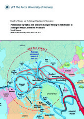
Palaeoceanographic and climate changes during the Holocene in Hinlopen Strait, northern Svalbard
(Mastergradsoppgave; Master thesis, 2023-05-20)This study investigates the paleoceanographic changes in the Hinlopen Strait, situated between Spitsbergen and Nordaustlandet, through a multi-proxy analysis of sediment core HH15-1280-GC (439 m water depth). Located near the Polar Front, this region is highly sensitive to even minor alterations in the ocean circulation and climate, which can be reconstructed from marine sediment records. The core ... -
Garnet growth and mineral geochronology constrains the diachronous Neoproterozoic convergent evolution of the southern Dom Feliciano Belt, Uruguay
(Journal article; Tidsskriftartikkel; Peer reviewed, 2023-05-15)The Dom Feliciano Belt of southern Brazil and Uruguay represents part of a larger Neoproterozoic orogenic system formed during the amalgamation of Western Gondwana. The hinterland and foreland domains in parts of the belt preserve deformation structures and metamorphic assemblages that developed during early crustal thickening from c. 650 Ma. However, the metamorphic history of the southern foreland, ... -
Plume–lithosphere interactions and LIP-triggered climate crises constrained by the origin of Karoo lamproites
(Journal article; Tidsskriftartikkel; Peer reviewed, 2023-04-20)We identified a ca. 180 Ma diamondiferous lamproite event in Zambia, establishing a link between ultrapotassic volcanism and the early Jurassic Karoo flood basalt province of sub-Saharan Africa. The cratonic lamproites erupted through the Permo–Triassic Luangwa Rift structure, but MgO-rich ultrapotassic magma formation was unrelated to rifting and triggered by plume–lithosphere interactions during ...