
 English
 norsk
norskInstitutt for geovitenskap: Recent submissions
Now showing items 1001-1020 of 1121
-
A shallow gas flat spot anomaly in the Bjørnøyrenna Fault Complex in the Barents Sea: processing and interpretation of P-Cable 3D seismic data
(Master thesis; Mastergradsoppgave, 2015-05-18)This thesis analyzed P-Cable high-resolution 3D seismic data from the Bear Island Fault Complex in the southwestern Barents Sea acquired during a Helmer Hanssen cruise in 2012. Hence, the thesis is divided into two parts: the first part of the thesis focuses on the steps taken during the processing of the raw seismic data from the Lundin 2012 Area-A survey located at the Bear Island Trough Fault ... -
Undersøkelse av ustabilt fjellparti ved Adjet, Storfjord, Troms. Betydningen av ulike kategorier av glideplan i berggrunnen og mekanismer for utglidning
(Master thesis; Mastergradsoppgave, 2015-05-15)Strukturelle element i berggrunnen kan ha stor betydning for utvikling av ustabile fjellparti og fjellskred. I dette studiet vil det fokuseres på hvilken rolle strukturelle element i berggrunnen har hatt å si for skredhendelsene og deformasjonen i området og hvordan disse har preget det geologiske bildet. Det ustabile fjellpartiet er lokalisert på fjellet Adjet ved tettstedet Skibotn i Storfjord ... -
Sedimentary processes and paleoenvironments in St. Jonsfjorden, western Spitsbergen
(Master thesis; Mastergradsoppgave, 2015-05-19)Multibeam (swath) bathymetry, high-resolution two-dimensional seismic (chirp) profiles and four gravity cores have been analyzed to reconstruct the Late Weichselian and Holocene sedimentary environments and glacier dynamics in St Jonsfjorden, central western Spitsbergen (Svalbard). The sediment cores comprise stratified glacimarine sediments with varying amounts of ice rafted debris. Three cores ... -
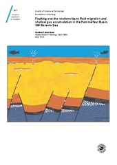
Faulting and the relationship to fluid migration and shallow gas accumulation in the Hammerfest Basin, SW Barents Sea
(Master thesis; Mastergradsoppgave, 2015-05-01)This thesis has focused its efforts to identify and map faults and their relationships to shallow gas accumulations and fluid flow features. The area of this investigation lies in the hydrocarbon-prone Hammerfest Basin in the southwestern Barents Sea, above the Base Cretaceous. Nine 3D seismic datasets were used in this study, aiming to improve the knowledge of the timing of the tectonic activity ... -
Asynchronous response of marine-terminating outlet glaciers during deglaciation of the Fennoscandian Ice Sheet
(Journal article; Tidsskriftartikkel; Peer reviewed, 2014-03-31)Recent studies have highlighted the dynamic behavior of marine-terminating outlet glaciers over decadal time scales, linked to both atmospheric and oceanic warming. This helps explain episodes of nearly synchronous fl ow acceleration, thinning, and retreat, but nonclimatic factors such as changes in fjord width and depth, can also induce rapid recession. There is support for these topographic ... -
Geomorfologisk og strukturgeologisk studium av fjellskredet ved Falsnesfjellet, Storfjord, Troms
(Master thesis; Mastergradsoppgave, 2014-04-08)Geomorfologisk og strukturgeologisk studium av fjellskredet ved Falsnesfjellet, Storfjord, Troms -
Optimising the use of marine tephrochronology in the North Atlantic: a detailed investigation of the Faroe Marine Ash Zones II, III and IV
(Journal article; Tidsskriftartikkel; Peer reviewed, 2014) -
A North Atlantic tephrostratigraphical framework for 130–60 ka b2k: new tephra discoveries, marine-based correlations, and future challenges
(Journal article; Tidsskriftartikkel; Peer reviewed, 2014) -
Temporal and spatial structure of multi-millennial temperature changes at high latitudes during the Last Interglacial
(Journal article; Tidsskriftartikkel; Peer reviewed, 2014) -
Semibrittle deformation and partial melting of perthitic K-feldspar: An experimental study
(Journal article; Tidsskriftartikkel; Peer reviewed, 2014) -
Linking onshore-offshore basement rock architecture and brittle faults on the submerged strandflat along the SW Barents Sea margin, using high-resolution (5 x 5 m) bathymetry data
(Journal article; Tidsskriftartikkel; Peer reviewed, 2014) -
Carbon isotope (d13C) excursions suggest times of major methane release during the last 14 ka in Fram Strait, the deep-water gateway to the Arctic
(Journal article; Tidsskriftartikkel; Peer reviewed, 2014) -
Subglacial roughness of the former Barents Sea ice sheet
(Journal article; Tidsskriftartikkel; Peer reviewed, 2013)The roughness of a glacier bed has high importance for the estimation of the sliding velocity and can also provide valuable insights into the dynamics and history of ice sheets, depending on scale. Measurement of basal properties in present-day ice sheets is restricted to ground-penetrating radar and seismics, with surveys retrieving relatively coarse data sets. Deglaciated areas, like the Barents ... -
Re-evaluation and extension of the Marine Isotope Stage 5 tephrostratigraphy of the Faroe Islands region: The cryptotephra record
(Journal article; Tidsskriftartikkel; Peer reviewed, 2014) -
A Late Glacial–Early Holocene multiproxy record from the eastern Fram Strait, Polar North Atlantic
(Journal article; Tidsskriftartikkel; Peer reviewed, 2014) -
On Palaeozoic-Mesozoic brittle normal faults along the SW Barents Sea margin: fault processes and implications for basement permeability and margin evolution
(Journal article; Tidsskriftartikkel; Peer reviewed, 2014) -
Submarine gas seepage in a mixed contractional and shear deformation regime: Cases from the Hikurangi oblique-subduction margin
(Journal article; Tidsskriftartikkel; Peer reviewed, 2014-02-11) -
Role of tectonic stress in seepage evolution along the gas hydrate-charged Vestnesa Ridge, Fram Strait
(Journal article; Tidsskriftartikkel, 2015-02-03) -
Strukturer og mineralomvandling i Stensundtjern malmfelt, og dannelse av jernmalmene i Dunderlandsformasjonen.
(Master thesis; Mastergradsoppgave, 2014-12-14)Stensundtjern ligger ved Storforshei, en hall times kjøring fra Mo i Rana. Denne mineralforekomsten er en del av en større jernmineralisering som ligger i Dunderlandsdalen. Jernmineraliseringen her har vært kjent siden før 1800 og har gjennom årenes løp vært forsøkt drevet i flere perioder. De første kildene vi har fra området er fra 1799 da Trondheims-bedriften Mostadsmarkens Jernverk gjorde krav ... -
Post-glacial sedimentary processes and slope instabilities off Nordnesfjellet, Lyngenfjorden, northern Norway
(Master thesis; Mastergradsoppgave, 2014-11-15)The Lyngen- and Storfjorden system, Troms County, northern Norway, is surrounded by an alpine landscape, partly with steep mountain sides. Parts of the ~700 m high mountain Nordnesfjellet, on the eastern side of the fjord, are currently moving downslope, and could in the event of sudden failure generate tsunami waves which would affect low-lying areas within a larger region. The main objective of ...