
 English
 norsk
norskInstitutt for geovitenskap: Recent submissions
Now showing items 841-860 of 1121
-
Middle to Late Devonian–Carboniferous collapse basins on the Finnmark Platform and in the southwesternmost Nordkapp basin, SW Barents Sea
(Journal article; Tidsskriftartikkel; Peer reviewed, 2018-03-28)The SW Barents Sea margin experienced a pulse of extensional deformation in the Middle–Late Devonian through the Carboniferous, after the Caledonian Orogeny terminated. These events marked the initial stages of formation of major offshore basins such as the Hammerfest and Nordkapp basins. We mapped and analyzed three major fault complexes, (i) the Måsøy Fault Complex, (ii) the Rolvsøya fault, and ... -
Methane cold seeps as biological oases in the high-Arctic deep sea
(Journal article; Tidsskriftartikkel; Peer reviewed, 2017-10-27)Cold seeps can support unique faunal communities via chemosynthetic interactions fueled by seabed emissions of hydrocarbons. Additionally, cold seeps can enhance habitat complexity at the deep seafloor through the accretion of methane derived authigenic carbonates (MDAC). We examined infaunal and megafaunal community structure at high-Arctic cold seeps through analyses of benthic samples and ... -
The Cenozoic pre-glacial tectono-stratigraphy and erosion estimates for the NW Barents Sea
(Conference object; Konferansebidrag, 2017-04-24) -
Seismic evidence for complex sedimentary control of Greenland Ice Sheet flow
(Journal article; Tidsskriftartikkel; Peer reviewed, 2017-08-16)The land-terminating margin of the Greenland Ice Sheet has slowed down in recent decades, although the causes and implications for future ice flow are unclear. Explained originally by a self-regulating mechanism where basal slip reduces as drainage evolves from low to high efficiency, recent numerical modeling invokes a sedimentary control of ice sheet flow as an alternative hypothesis. Although ... -
How robust are in situ observations for validating satellite-derived albedo over the dark zone of the Greenland Ice Sheet?
(Journal article; Tidsskriftartikkel; Peer reviewed, 2017-07-17)Calibration and validation of satellite‐derived ice sheet albedo data require high‐quality, in situ measurements commonly acquired by up and down facing pyranometers mounted on automated weather stations (AWS). However, direct comparison between ground and satellite‐derived albedo can only be justified when the measured surface is homogeneous at the length‐scale of both satellite pixel and in situ ... -
Sea-ice dynamics in an Arctic coastal polynya during the past 6500 years
(Journal article; Tidsskriftartikkel; Peer reviewed, 2016-12-23)The production of high-salinity brines during sea-ice freezing in circum-arctic coastal polynyas is thought to be part of northern deep water formation as it supplies additional dense waters to the Atlantic meridional overturning circulation system. To better predict the effect of possible future summer ice-free conditions in the Arctic Ocean on global climate, it is important to improve our ... -
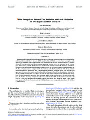
Tidal Energy Loss, Internal Tide Radiation, and Local Dissipation for Two-Layer Tidal Flow over a Sill
(Journal article; Tidsskriftartikkel; Peer reviewed, 2017-06-14)A simple analytical model for tidal energy loss at fjord sills and its partitioning into local dissipation and radiated internal tides is presented. The analytical model builds on a two-layer assumption with quasi-steady nonlinear flow over the sill and wave radiation in the far field. When the interface is situated above sill level, upstream- and downstream-propagating internal waves are generated ... -
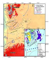
Diagenetic alteration of benthic foraminifera from a methane seep site on Vestnesa Ridge (NW Svalbard)
(Journal article; Tidsskriftartikkel; Peer reviewed, 2017-03-08)Anomalously low δ<sup>13</sup>C values in foraminiferal calcite tests are due to diagenetic alteration in methane seep sites. Our study applies diagenetically altered fossil benthic foraminiferal tests as geochemical tracers in reconstructing natural past methane seepage episodes at Vestnesa Ridge offshore NW Svalbard. We combine examinations of the test wall microstructure, mineralogical and stable ... -
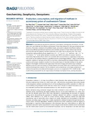
Production, consumption, and migration of methane in accretionary prism of southwestern Taiwan
(Journal article; Tidsskriftartikkel; Peer reviewed, 2017-07-15)To systematically quantify the production, consumption, and migration of methane, 210 sediment cores were collected from offshore southwestern Taiwan and analyzed for their gas and aqueous geochemistry. These data, combined with published results, were used to calculate the diffusive methane fluxes across different geochemical transitions and to develop scenarios of mass balance and constrain deep ... -
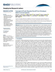
Supraglacial ponds regulate runoff from Himalayan debris-covered glaciers
(Journal article; Tidsskriftartikkel; Peer reviewed, 2017-11-29)Meltwater and runoff from glaciers in High Mountain Asia is a vital freshwater resource for one-fifth of the Earth’s population. Between 13% and 36% of the region’s glacierized areas exhibit surface debris cover and associated supraglacial ponds whose hydrological buffering roles remain unconstrained. We present a high-resolution meltwater hydrograph from the extensively debris-covered Khumbu ... -
Benthic foraminifera as bio-indicators of chemical and physical stressors in Hammerfest harbor (Northern Norway)
(Journal article; Tidsskriftartikkel; Peer reviewed, 2016-10-01)We investigated benthic foraminiferal assemblages in contaminated sediments in a subarctic harbor of northern Norway to assess their utility as indicators of anthropogenic impacts. Sediments in the harbor are repositories for POPs and heavy metals supplied through discharges from industry and shipping activities. Sediment contaminant concentrations are at moderate to poor ecological quality ... -
Environmental baselines and reconstruction of Atlantic Water inflow in Bjørnøyrenna, SW Barents Sea, since 1800 CE
(Journal article; Tidsskriftartikkel, 2017-10-28)Metal concentrations, sediment properties and benthic foraminiferal assemblages were investigated in sediment cores in the SW Barents Sea, to reconstruct environmental baselines and natural variability of Atlantic Water inflow since 1800 CE. Metal concentrations correspond to no effect levels and do not influence the foraminifera. Increased Hg and Pb was linked to inflow of Atlantic Water. The data ... -
Eurasian ice-sheet dynamics and sensitivity to subglacial hydrology
(Journal article; Tidsskriftartikkel; Peer reviewed, 2017-04-24)Ice-stream dynamics are strongly controlled by processes taking place at the ice/bed interface where subglacial water both lubricates the base and saturates any existing, underlying sediment. Large parts of the former Eurasian ice sheet were underlain by thick sequences of soft, marine sediments and many areas are imprinted with geomorphological features indicative of fast flow and wet basal conditions. ... -
Assessment of offshore wind power potential in the Aegean and Ionian<br> Seas based on high-resolution hindcast model results
(Journal article; Tidsskriftartikkel; Peer reviewed, 2017-03-20)In this study long-term wind data obtained from high-resolution hindcast simulations is used to analytically assess offshore wind power potential in the Aegean and Ionian Seas and provide wind climate and wind power potential characteristics at selected locations, where offshore wind farms are at the concept/planning phase. After ensuring the good model performance through detailed validation against ... -
Possible climate preconditioning on submarine landslides along a convergent margin, Nankai Trough (NE Pacific)
(Journal article; Tidsskriftartikkel; Peer reviewed, 2017-07-25)Submarine landslides are major agents of sediment mass transfer from the shallow to deep sea. Due to their rapid emplacement and tsunamigenic potential, such landslides are significant geohazards for society and off- and on-shore infrastructure. The relationship between climate change and the occurrence of submarine landslides is widely debated. However, there is a lack of continuous long-term ... -
Methane- and dissolved organic carbon-fueled microbial loop supports a tropical subterranean estuary ecosystem
(Journal article; Tidsskriftartikkel; Peer reviewed, 2017-11-28)Subterranean estuaries extend inland into density-stratified coastal carbonate aquifers containing a surprising diversity of endemic animals (mostly crustaceans) within a highly oligotrophic habitat. How complex ecosystems (termed anchialine) thrive in this globally distributed, cryptic environment is poorly understood. Here, we demonstrate that a microbial loop shuttles methane and dissolved organic ... -
Derivation of High Spatial Resolution Albedo from UAV Digital Imagery: Application over the Greenland Ice Sheet
(Journal article; Tidsskriftartikkel; Peer reviewed, 2017-05-23)Measurements of albedo are a prerequisite for modeling surface melt across the Earth’s cryosphere, yet available satellite products are limited in spatial and/or temporal resolution. Here, we present a practical methodology to obtain centimeter resolution albedo products with accuracies of ±5% using consumer-grade digital camera and unmanned aerial vehicle (UAV) technologies. Our method comprises ... -
Sedimentology of the Lower Cretaceous at Kikutodden and Keilhaufjellet, southern Spitsbergen: implications for an onshore-offshore link
(Journal article; Tidsskriftartikkel; Peer reviewed, 2017-04-10)Detailed sedimentological investigations of the Lower Cretaceous succession of southernmost Spitsbergen indicate deposition during a long-term fall and rise in relative sea level. The Rurikfjellet Formation shows an overall regressive development and consists of offshore deposits grading upwards into progradationally stacked shoreface parasequences. The overlying Helvetiafjellet Formation shows a ... -
Limited grounding-line advance onto the West Antarctic continental shelf in the easternmost Amundsen Sea Embayment during the last glacial period
(Journal article; Tidsskriftartikkel; Peer reviewed, 2017-07-25)Precise knowledge about the extent of the West Antarctic Ice Sheet (WAIS) at the Last Glacial Maximum (LGM; c. 26.5–19 cal. ka BP) is important in order to 1) improve paleo-ice sheet reconstructions, 2) provide a robust empirical framework for calibrating paleo-ice sheet models, and 3) locate potential shelf refugia for Antarctic benthos during the last glacial period. However, reliable reconstructions ... -
Surface water conditions and calcium carbonate preservation in the Fram Strait during marine isotope stage 2, 28.8–15.4 kyr
(Journal article; Tidsskriftartikkel; Peer reviewed, 2014-01-14)We present a high-resolution record of calcium carbonate preservation alongside the distribution pattern of planktic foraminifera from the Fram Strait. The record covers the marine isotope stage (MIS) 2, 28.8 to 15.4 kyr, including the Last Glacial Maximum (LGM) and the early deglaciation in multidecadal temporal resolution. The investigation is based on the distribution patterns of planktic ...